
The Orkney Image Library
Help us get organised! If we haven't correctly identified which area this picture is best listed under, please select it below and click Done!
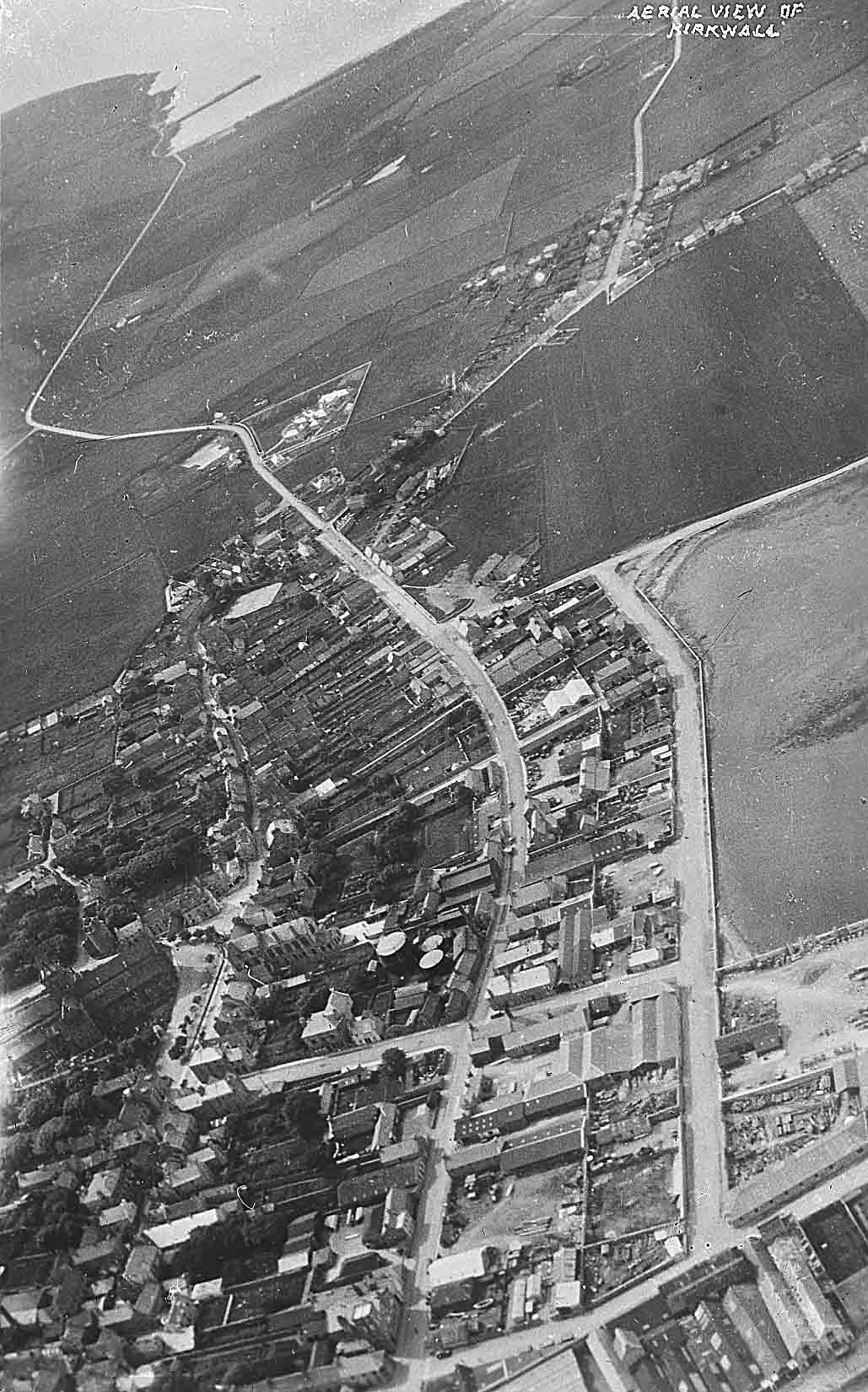
Aerial view of Kirkwall
[Date guessed. I suspect I may have posted this one before, but hey. its a great picture! Gasworks, old Power Station, no Post Office or bus station or car parks, The Mart, Great Western Road still new, tennis courts at Costies, nothing beyond the Clay Loan, no distillery ponds, the hospital on its own outside the town, with a quarry opposite it, small building attached to the Toon Haal that may have made way for the Community Centre/Cavern/Youth Cafe... -Steven]
 View Large Version
Picture added on 14 June 2017 at 21:10
It cannot be earlier than 1930 as the houses nos. 2 - 8 Victoria St have been knocked down and the space which is now the car park opposite the RBS is there. G.W.Road was created by the end of WW1 and most of the builsinds on the landward side of it are all there and they date from 1920's. That will do for now.
Added by David Partner on 26 June 2017
When this picture was posted as picture #762, the date was given as 1931.
Added by Paul Sutherland on 27 June 2017
Roebank, which appears as the only house on the North side of High Street with open fields between it and the Picky Road, was built in 1929.
<< back
Anonymous comment added on 11 July 2017
Stromness


