The Orkney Image Library
Help us get organised! If we haven't correctly identified which area this picture is best listed under, please select it below and click Done!
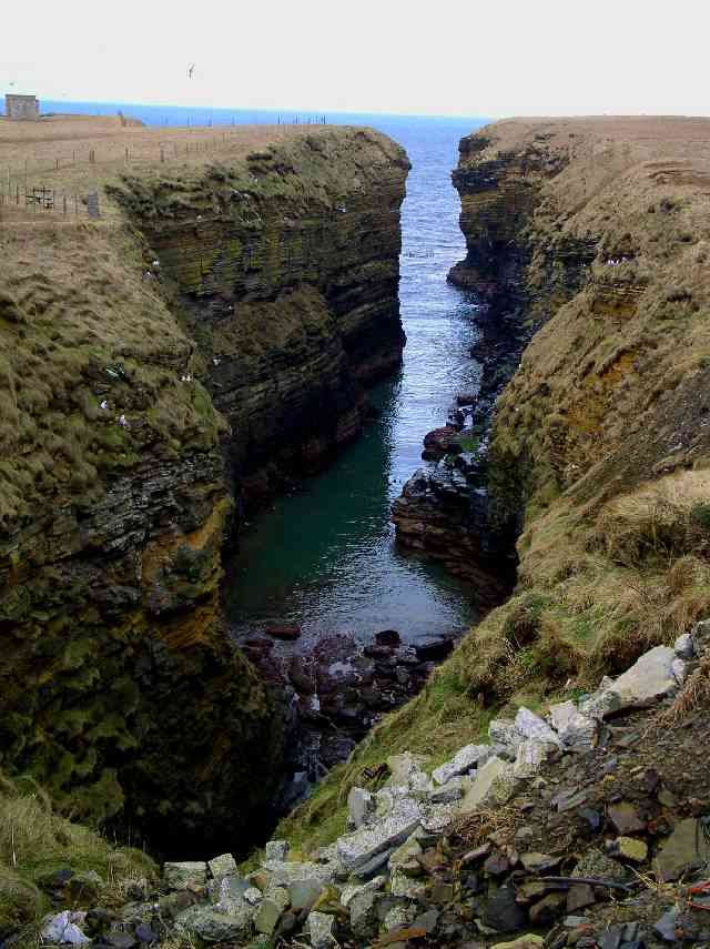
Taken on 26th February. I went to check this out as I found an old map of the area (on http://www.old-maps.co.uk, a great site) which promised natural arches, and subterranean passages and caves. I was clearly a few generations late for the natural arches.
This is at Northside, head along the road from the crossroads with the main road, then turn right, basically till the end of the road. You can probably walk round from the Point of Buckquoy too.
Picture added on 26 April 2005
The wonderful thing about Lang Geo is that it has two small streams running into it and after rain, there are cascades with the sound of tumbling water- rare in Orkney. The road to it has interesting gardens and plants in summer and if you continue along the cliffs back towards the Brough, the remains of wartime gun stations are just about visible.
Added by anne forbes on 12 December 2005
The name is Longa glebe, my spelling may be wrong.
<< back
Anonymous comment added on 14 June 2008
Birsay