The Orkney Image Library
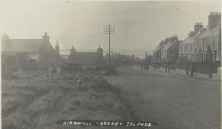
No: 6052 Contributor: Kirkwallian Year: 1909
Help us get organised! If we haven't correctly identified which area this picture is best listed under, please select it below and click Done!
Old post card looking down dundas crescent from top of the clay loan. [Spot the water fountain in the long grass- Steven]
 View Large Version
Picture added on 14 November 2007
Looking at the OS map surveyed 1880 published 1882 it is interesting to see that where the pump is in this picture it was actually at that time a small pond with a pump on the right further down the street before St Olafs Church. Also can anyone shed light on the fact that in this 1880 map it seems that Union Street And Clay Loan are actually the other way around with the Clay loan being the shorter stretch at the bottom from the branch of Victoria and Main Street?
Added by Mark Vincent on 23 April 2015
Yes I have that 1880 map and the 1902 one and I noticed the inversion of Union Street and Clay Loan. I'll have to take a look at Hossack to see if he says anything though he always calls the road to Gallowha Clay Loan. Maybe the Census of 1871 or the Valuation Rolls for that year and 1880 might shed some light.
<< back
Added by David Partner on 06 May 2015
Streets


[Thanks David, I concur re Bignold Park Road. And now I know that you are not the mysterious Kirkwallian - Steven]