The Orkney Image Library
Help us get organised! If we haven't correctly identified which area this picture is best listed under, please select it below and click Done!
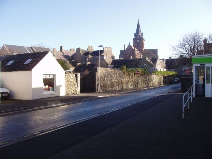
Note how far back the No Entry signs are. I was told that this is because the end of Tankerness Lane was an old drovers road, and that there are legal difficulties about closing it. Can anyone tell me if this is fact or myth? Photo Feb 2011.
 View Large Version
Picture added on 15 April 2011 at 12:14
Tankerness Lane has always been two way up to the No Entry signs in my memory - presumably to allow access to business premises.
Added by Ian M Gibson on 15 April 2011
fact
Added by MARION MCLEOD on 15 April 2011
I think the reason is the practical one of allowing access as Ian says, especially for larger vehicles that would be unable to negotiate the bottleneck at the top of the lane. I've a feeling the signs used to be a bit further down, which might suggest the original reason was to avoid restricting cars getting in and out from J & W Tait's petrol pumps which used to be at the corner. As for the drovers road theory, until the mid 19th century the bottom part of the lane did not exist. This was the shore of the Peerie Sea and so under water a lot of the time.
Added by Paul Sutherland on 17 April 2011
I tend to agree with Paul, the signs used to be just above the lower entry to Tankerness House gardens - again this could have been an access issue for the gardeners vehicles.
Added by Anonymous2 on 18 April 2011
Kirkwall


