The Orkney Image Library
Help us get organised! If we haven't correctly identified which area this picture is best listed under, please select it below and click Done!
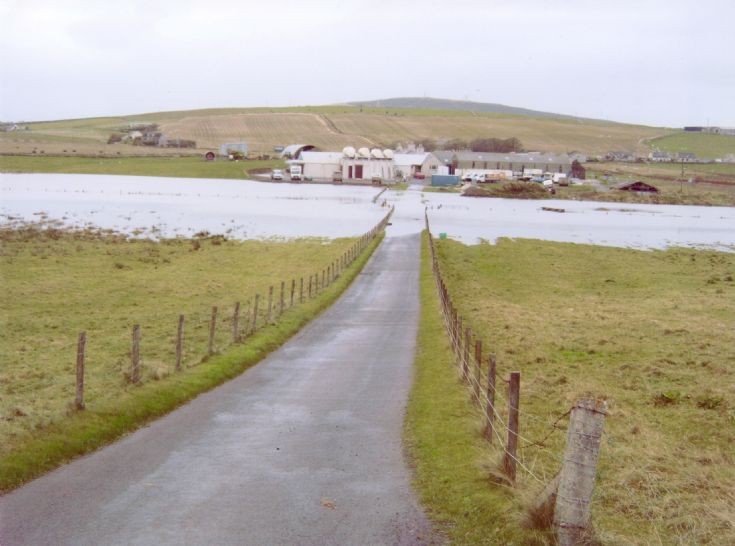
Photo taken 26th 10 2006, the Crantit Canal and valley flooded from the foot of the Holm Branch, out to near Scapa beach road. This was after high tides, strong Northerly winds and torrential rain, causing flooding all over areas of Kirkwall near sea level and the Papdale housing area. Added by Phil Brough.
Picture added on 22 October 2009 at 17:34
This picture is in the following groups
Flood 26-10-06
Flood 26-10-06
Thanks to Dave Smith and Fiona Bain,this photo is now in the right perspective,thanks also to Steven for changing it. Added by Phil Brough.
Added by Phil Brough on 22 October 2009
No doubt Steven didn't straighten the picture while he was at it in the hope that the water would eventually drain away downhill. (Judging by his caption for Craig Taylor's Statsraad Lehmkuhl, he's a bit of a stickler for the straight-and-level.)
<< back
Added by Ian Hourston on 24 October 2009
St Ola