The Orkney Image Library
Help us get organised! If we haven't correctly identified which area this picture is best listed under, please select it below and click Done!
Date estimated.
Peter writes:
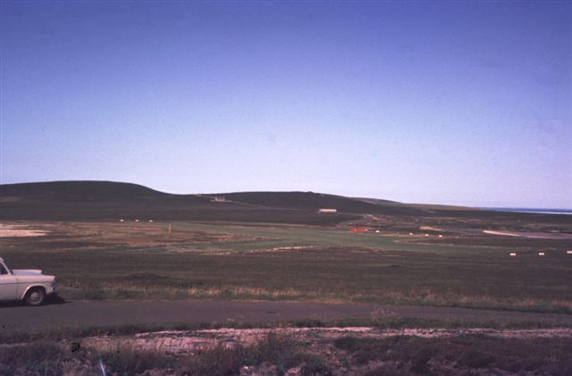
"Eday airport,again taken in the 1970's, this time from the west side road ,looking north. This is where the island is at it's narrowest point. On the left is the Sands o' Doomy and on the right is the shore of The Bay of London. Again,on the right horizon, can be seen Sanday with a strip of Eday Sound in between.The main road can be seen winding north, the first building being the Community Center and then further north , the building formerly known as The Baptist Chapel.
At this time as I remember, the runway for the Islander Aeroplanes was grass among the heather,not quite so good as it is today, but served it's purpose nevertheless."
Picture added on 01 November 2006
Eday


